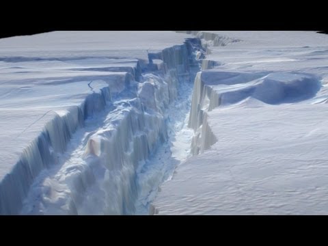
字幕表 動画を再生する
IceBridge is off to a strong start this year, having completed seven science missions over
outlet glaciers, sea ice, and ice sheets and covering a broad range of territory both east
and west of the Antarctic peninsula.
Until today, the mission had yet to feature a return to the site of last year's discovery
of a massive rift in the Pine Island Glacier, a huge flow of ice that has been called the
weak underbelly of the West Antarctic Ice sheet. Satellite images show the glacier has
not calved yet, but when it does, could produce an iceberg the size of New York City. Keep
in mind that the main science objective of Operation IceBridge is to study how ice is
changing in polar regions on a much broader scale, not searching out calving events. But
being at the right place at the right time provided a scientific bonus.
IceBridge often passes the scenic Antarctic Peninsula on its way to survey the continent's
ice sheets, glaciers, and surrounding sea ice. The peninsula's mountains are habitually
shrouded by clouds but today we have a clear view. As we descend, we see vast fields of
sea ice. Large pieces of sea ice are called floes and these formations often collide,
creating thick ridges along their edges, or raft over top of each other. This ice appears
to be thick enough to be 2nd-year ice, or ice which survived a summer melt season. Darker,
grayer ice appears to be more recent, and might be around 10 cm thick, while the white
ice covered by snow is probably more than 30 cm thick.
The area in the lower center here is so smooth, it might just be a few hours old. This is
frazil ice. It's granular, like a slushy beverage, and is created by very dynamic conditions
of turbulence in the water. This is a region of brash, containing sea ice and a few icebergs.
IceBridge measures Antarctic ice from 500 meters above the surface, using radar, laser
altimetry, and with these crisp images from the DMS or Digital Mapping System. Here we
have ice that's holding fast to the shore, and immobilizing icebergs created from a nearby
glacier or ice shelf. These slabs of ice from continental ice shelves, sticking above the
water by perhaps 50 meters are large and flat enough to be called tabular bergs. Finally,
the slowly setting sun lights up cracks or leads in the sea ice as we head for home.
Operation IceBridge has now returned to the Pine Island Glacier, not once, but twice in
2012. And the year-old giant crack in the glacier, poised to create an iceberg the size
of New York City? Well it's still there, and that iceberg has yet to break free. But the
rift has grown longer, much wider, and spawned a secondary crack. Before we talk about when
that mighty berg will be born, let's take a look at the IceBridge missions themselves.
IceBridge's first return to the glacier was a high altitude flight over the entire region,
including the Thwaites, Smith, and Kohler glaciers. After this campaign is over, scientists
will be able to compare this broad survey with previous years' measurements in order
to better document the rapid and widespread changes in the region over time.
For the second mission, NASA's DC-8 flew, as it does for most IceBridge flights, at
500 meters above the ice, and this mission was about creating a brand new set of data.
The flight lines took the team over previously unmeasured tributaries of the glacier, and
also surveyed the bedrock below them, to provide a baseline for measuring change in the future.
So why all this focus on the Pine Island region? NASA Goddard calving specialist Kelly Brunt
says the ice in the region is substantially thinning and its flow is accelerating.
Ultimately the change that we see in that whole region, not just Pine Island but also
its neighbor, Thwaites Glacier, this change represents the largest input to sea level
rise from an Antarctic source.
The rift has been an intriguing phenomenon to watch over this last year, but is it a
really important event?
When we talk about Antarctica and we talk about the health and state of our ice sheets,
we talk about mass balance. And what you have on one side of the mass balance equation is
accumulation, or snowfall coming in. And when we talk about balance, that has to be balanced
by things coming out. And in Antarctica that happens either through surface melt, or basal
melt, or the big number, in Antarctica, which is calving. Calving accounts for 80 percent
of that side of the equation. So when you see calving in Antarctica, even even calving
when we use small states or the island of Manhattan as a unit of measure - this is generally
very normal - it's part of the process.
However, Brunt says once the glacier calves, the new calving front will be further upstream
from any calving front we've seen in the last 40 years.
I've used the analogy of a fingernail, to talk about calving. Generally, if your nail
breaks in the white, it's normal and you don't worry about it. If your nail breaks below
the white, you think about it, you remember it. If you lose your whole nail, that's a
big deal. Much of the calving, the 80% of the net loss through calving, can be equated
to losing the white part of your fingernail. Things that we saw in the early 2000s in the
Antarctic Peninsula side, the Larsen A the Larsen B ... that's equivalent to losing your
whole nail. What's going on in Pine Island is probably that intermediate. We've broken
our nail and it's below the white and it's something to watch and it's something to monitor
over time.
As a byproduct of the recent IceBridge flights, the team got some great views - and measurements
- of the evolving crack, which has been filled in somewhat by blowing snow. The crack appears
to only have a short distance to go before a new iceberg is born. It's still hard to
know when that will happen, but conditions seem to be right.
Sea ice acts as a buttress or a dampener to sea swell that actually protects the front
of these ice shelves or the front of these glaciers from calving. So the fact that there's
no sea ice in front of the Pine Island Glacier right now implies that it might be in a state
that's sort of primed to calve.
After IceBridge heads back home from this campaign, its data will be used to monito
the state of Antarctic ice sheets, while satellites will continue to watch the rift in the Pine
Island Glacier as the melt season continues.
Today's mission was called the Recovery Offshore 01 mission, made up of six parallel lines
spaced at 20 kilometers. It's called that because we concentrate on the area where the
Recovery glacier, which is a major glacier in this part of east Antarctica, drains into
the Filchner Ice Shelf. It tends to be difficult to get measurements to help us understand
the shape of the cavity of water, ocean water beneath an ice shelf such as the Filchner,
especially a big one like the Filchner. With our gravity instruments and our radar instruments
on board the DC-8 we are able to collect measurements which allow analysts and scientists to deduce
the shape of those underwater cavities. And that's important because it by knowing the
shape of those cavities, scientists can begin to get at the interaction of these glaciers
with warm ocean waters. Which, it has been determined within the last decade or two by
the glaciological community that the interaction of these large glaciers and warming ocean
waters tend to be quite important in determining their future behavior.