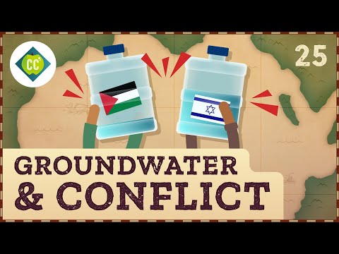
Placeholder Image

字幕表 動画を再生する

AI 自動生成字幕
  • When some of us think of the Middle East and North Africa, we might picture images of sand dunes stretching as far as the eye can see, or giant oil rigs pumping black gold from the ground.

    中東や北アフリカといえば、見渡す限り広がる砂丘や、地中から黒い金を汲み上げる巨大な石油掘削施設を思い浮かべる人もいるだろう。

  • But for the people who live here, the most critical resource is water.

    しかし、ここに住む人々にとって最も重要な資源は水である。

  • To some geographers, the map of the world's precipitation is the most important map for understanding life on Earth. And nowhere is this more true than in the Middle East and North Africa, or MENA, which includes vast deserts like the Sahara. With maps of precipitation and available water on the Earth's surface, we can think about why people are clustered where they are, and the conflicts water can create. While controlling surface water, like lakes and rivers, gets a lot of attention, there's an invisible source of water creating tensions and challenges, too. In fact, groundwater stored in the ground supplies nearly half the world's drinking water.

    一部の地理学者にとって、世界の降水量地図は地球上の生命を理解する上で最も重要な地図である。そして、サハラ砂漠のような広大な砂漠を含む中東・北アフリカ地域(MENA)ほどそれが当てはまる地域はない。地表の降水量と利用可能な水の地図があれば、なぜ人々がその場所に集まっているのか、そして水が引き起こす対立について考えることができる。湖や川のような地表水をコントロールすることが注目される一方で、目に見えない水源も緊張や課題を生み出している。実は、地下に蓄えられた地下水が世界の飲料水の半分近くを供給しているのだ。

  • And in the Middle East and North Africa, an estimated 90% of freshwater, whether in rivers or underground aquifers, crosses one or more international borders, involves multiple stakeholders and political conflicts, and is embedded in a complicated physical geography.

    また、中東と北アフリカでは、河川であれ地下帯水層であれ、淡水の推定90%が1つ以上の国境を越え、複数の利害関係者と政治的対立を伴い、複雑な物理的地理に組み込まれている。

  • All of which make managing water, especially water we can't see, an extraordinary challenge.

    これらすべてが、水、特に目に見えない水を管理することを並大抵のことではない課題にしている。

  • I'm Alizé Carrère and this is Crash Course Geography.

    アリゼ・カレールです。クラッシュ・コース・ジオグラフィーです。

  • INTRO

    イントロ

  • Over the last two episodes, we've been exploring water and the different ways we're connected to it. And in this final water episode, we'll tell one more part of water's story. Like rivers on the surface that unite and divide us, whether we use groundwater to control others or choose to share can shape our path to peace. In fact, only about 2.8% of all the water on Earth is freshwater, or water that doesn't contain a lot of salt that we can use for drinking and growing things.

    過去2回のエピソードで、私たちは水とさまざまな関わり方を探ってきた。そして最終回となる今回は、水の物語をもうひとつ紹介しよう。地表を流れる川が私たちを結びつけたり分断したりするように、地下水を使って他者をコントロールするか、それとも分かち合うかを選ぶかによって、私たちの平和への道が形作られる。実際、地球上の全水のうち、淡水、つまり私たちが飲料や栽培に利用できる塩分をあまり含まない水は、わずか2.8%しかない。

  • All the other water on Earth is saltwater in the oceans. Of that freshwater, over two-thirds of it is locked up in ice sheets and glaciers, and a tiny amount is found in rivers and lakes.

    地球上の他の水はすべて海にある海水である。淡水のうち3分の2以上は氷床や氷河に閉じ込められており、川や湖にあるのはごくわずかである。

  • The rest lies beneath Earth's surface. So groundwater makes up a little more than half of a percent of all the water on Earth, yet it's the largest potential source of freshwater we've got in the entire hydrological cycle that moves water between the four Earth systems.

    残りは地表の地下にある。つまり、地下水は地球上の全水の半分強を占めるに過ぎないが、4つの地球システムの間で水を移動させる水循環全体から見れば、最大の淡水源となり得るのだ。

  • Looking at a map of groundwater use, we'd see that's not such a great thing for large parts of the Middle East and North Africa, which is the most water-scarce region in the world.

    地下水の利用状況を地図で見ると、中東と北アフリカの大部分は世界で最も水の乏しい地域である。

  • Several countries have a groundwater stress rate of more than 100%, which means we're using up the groundwater resources faster than they can be refilled or recharged. You see, groundwater is the part of the hydrosphere stored within the lithosphere.

    地下水ストレス率が100%を超えている国もいくつかある。つまり、地下水資源が涵養されるよりも早く使い果たされているのだ。地下水とは、岩石圏に存在する水圏の一部である。

  • But it's still connected to the other spheres on and above the surface. Precipitation that absorbs into the ground before reaching a river can recharge aquifers and other underground reservoirs.

    しかし、地表やその上にある他の球体とはまだつながっている。河川に到達する前に地中に吸収された降水は、帯水層やその他の地下貯水池を涵養することができる。

  • So groundwater isn't an independent source of water, like we saw last time in Jakarta.

    つまり地下水は、前回ジャカルタで見たような独立した水源ではないのだ。

  • And this connection between groundwater and precipitation is specifically an issue because the Middle East and North Africa sits under a subtropical high-pressure belt.

    中東と北アフリカは亜熱帯高気圧帯の下にあるため、地下水と降水量の関係は特に問題となる。

  • Which means very little rain falls, and the main way we'd describe the climate is arid, or dry.

    つまり、雨はほとんど降らず、乾燥した気候ということになる。

  • There can even be a moisture deficit, which is when the amount of moisture that evaporates is more than returns as precipitation.

    水分不足になることもある。これは、蒸発する水分の量が降水量として戻る量を上回る場合である。

  • When it does rain, any extra water that absorbs into the ground moves through a zone of aeration, where the rocks and soil aren't fully saturated, and there's both air and water.

    雨が降った場合、地中に吸収された余分な水は、岩や土が完全に飽和しておらず、空気と水の両方が存在する通気ゾーンを移動する。

  • As gravity pulls it deeper, the water eventually reaches the zone of saturation, which is the layer where every space in the bedrock, regolith, and soil are filled with water.

    重力に引っ張られ、水はやがて飽和帯に達する。飽和帯とは、岩盤、レゴリス、土壌のあらゆる空間が水で満たされた層である。

  • We call the very top of the zone of saturation the water table, and this sort of imaginary line can shift depending on where we are.

    私たちは飽和帯の最上部を水位と呼んでいるが、この想像上の線は場所によって変化する。

  • The water table might be deeper or shallower depending upon the physical characteristics of the region, the input from precipitation, and the output into lakes, streams, and marshes, or during periods of drought.

    水位は、地域の物理的特性、降水による流入量、湖沼、河川、沼地への流出量、または干ばつの期間によって、深くなったり浅くなったりする。

  • Like in the Middle East and North Africa, precipitation patterns in rivers like the Nile,

    中東や北アフリカのように、ナイル川のような河川では降水パターンが変化する、

  • Tigris, and Euphrates guide where there's agriculture and where people settle.

    チグリス、ユーフラテスは農業が盛んで、人々が定住する場所を案内している。

  • But life can also flourish in oases, where erosion has lowered the land surface, and a relatively high water table means the zone of saturation is close to the surface.

    しかし、浸食によって地表が下がり、水位が比較的高いため飽和水域が地表に近いオアシスでは、生命が繁栄することもある。

  • How much water can be absorbed in the zone of saturation, or its porosity, and whether or not it's permeable and lets water flow depends on the makeup of the soil and rock.

    飽和帯でどれだけの水を吸収できるか、つまり多孔質であるかどうか、そして透水性があり水が流れるかどうかは、土壌と岩石の構成に左右される。

  • That includes the mineral composition, how the particles are arranged, their grain size, and what's between them.

    鉱物の組成、粒子の並び方、粒の大きさ、粒子と粒子の間にあるものなどだ。

  • In fact, aquifers aren't big pools of water beneath the surface.

    実際、帯水層は地表の下にある大きな水溜りではない。

  • They're really permeable rock masses that easily store groundwater and act as a water supply.

    地下水を貯めやすく、水源として機能する透水性の岩塊なのだ。

  • Like, the groundwater that supplies those oases is often recharged by rainfall entering other aquifers far outside the desert.

    オアシスに供給される地下水は、砂漠のはるか外側の帯水層に降った雨によって涵養されることが多い。

  • The groundwater very slowly moves down and horizontally through porous soil and rock in mountainous areas.

    地下水は、山間部では多孔質の土壌や岩盤をゆっくりと水平方向に移動する。

  • In general, layers of sedimentary rock like sandstone or limestone, or deposits of sand and gravel, are good aquifers because they're permeable and can hold a large amount of groundwater.

    一般に、砂岩や石灰岩のような堆積岩の層、あるいは砂や砂利の堆積層は、浸透性が高く大量の地下水を保持できるため、帯水層として適している。

  • But on the other hand, clay and shale beds are relatively impermeable and are called aquitards.

    しかし一方で、粘土層や頁岩層は比較的不透水性であり、帯水層と呼ばれる。

  • So, though we can find groundwater at almost every location on land that receives rainfall, the amount of precipitation, the rate of evaporation, the character of the ground, the amount and type of vegetation, and the porosity and permeability of soils and rocks make it a vastly unequal resource.

    そのため、降雨のある土地のほとんどすべての場所で地下水を見つけることができるが、降水量、蒸発率、地盤の性質、植生の量と種類、土壌と岩石の多孔性と浸透性によって、地下水は非常に不平等な資源となっている。

  • And where major water resources like aquifers and rivers are actually distributed is complex, especially when they cross one or more international borders.

    また、帯水層や河川といった主要な水資源が実際にどこに分布しているかは複雑で、特にそれらが1つ以上の国際的な国境を越えている場合はなおさらである。

  • Take the Arab-Israeli conflict, which is the ongoing political tensions and military conflicts between Arab nations and Israel and one of the longest and most complex disputes in the world.

    アラブ・イスラエル紛争を例にとると、アラブ諸国とイスラエルの間で政治的緊張と軍事的対立が続いており、世界で最も長く複雑な紛争のひとつである。

  • It's often seen as a conflict over land, but it's also about life-giving water on and beneath the land.

    土地をめぐる争いと思われがちだが、土地の上や地下にある生命を育む水の問題でもある。

  • This includes the eastern Mediterranean region often called the Levant, where highly productive aquifers made of limestone and dolomite that cross boundaries create some unique challenges.

    この地域には、レバントと呼ばれる地中海東部も含まれ、石灰岩とドロマイトからなる生産性の高い帯水層が境界を越えて存在するため、いくつかのユニークな課題がある。

  • There have been many ancient civilizations in this region, and some of the earliest references to water use, laws, and management can be found in the Code of Hammurabi, written in approximately 1780 BCE.

    この地域には多くの古代文明が存在し、水の利用、法律、管理に関する最も古い文献のいくつかは、紀元前1780年頃に書かれたハンムラビ法典に見ることができる。

  • But today we'll focus on more recent events, though for a more thorough history you can check out that episode from Crash Course World History 2.

    しかし、今日はもっと最近の出来事に焦点を当てよう。より詳しい歴史については、『クラッシュコース世界史2』のエピソードをご覧いただきたい。

  • The Six-Day War between the countries we call Israel, Egypt, Syria, and Jordan in 1967 rearranged not only the region's political landscape, but the water resource landscape, particularly in favor of Israel.

    1967年のイスラエル、エジプト、シリア、ヨルダンによる6日間戦争は、この地域の政治情勢だけでなく、水資源の情勢も、特にイスラエルに有利な方向に再編成した。

  • Among other land, Israel gained control of the entire West Bank from Jordan, including sources of water vital to Jordan, Syria, Lebanon, Palestine, and Israel.

    イスラエルは、ヨルダン、シリア、レバノン、パレスチナ、イスラエルにとって重要な水源を含むヨルダン川西岸地区全域をヨルダンから支配した。

  • In particular, the Western Basin, the Northeastern Basin, and the Eastern Basin, which make up the West Bank's aquifer system.

    特に、西岸地域の帯水層系を構成する西部盆地、北東部盆地、東部盆地である。

  • Together, these basins make up the Mountain Aquifer, which is a shared Israeli-Palestinian groundwater resource that lies under both Israel and what the United Nations calls the Occupied West Bank, where many Palestinians live.

    これらの流域を合わせて山岳帯水層と呼ぶ。山岳帯水層はイスラエルとパレスチナが共有する地下水資源で、イスラエルと国連が占領地と呼ぶヨルダン川西岸地区の地下にあり、多くのパレスチナ人が暮らしている。

  • It's replenished mostly by rain and snow absorbing into the ground in the West Bank, and flows north and west towards Israeli territory in one direction, and east towards the Jordan River in the other direction.

    ヨルダン川は、主にヨルダン川西岸地区で雨や雪が地中に吸収されることで水が補充され、北と西の一方向はイスラエル領に、もう一方は東のヨルダン川に向かって流れている。

  • The Mountain Aquifer is the largest and also one of the most important groundwater resources for Israel, and the sole remaining water resource for the Palestinians.

    山岳帯水層は、イスラエルにとって最大かつ最も重要な地下水資源であり、パレスチナ人にとっても残された唯一の水資源である。

  • But since 1967 when Israel began occupying the West Bank, strict water use policies have come into effect, creating an inequitable system in which Palestinians' access to this shared resource is highly regulated and restricted.

    しかし、イスラエルがヨルダン川西岸地区を占領し始めた1967年以降、厳格な水利用政策が施行され、パレスチナ人がこの共有資源を利用することが高度に規制・制限される不公平なシステムが生まれた。

  • Under the Interim Oslo II Accords of 1995, Israel retains control of all water resources.

    1995年のオスロ2世暫定合意では、イスラエルがすべての水資源を管理している。

  • They utilize 80% of the water from the aquifers under the West Bank, limiting Palestinians to 20%.

    彼らはヨルダン川西岸地区の地下帯水層の水の80%を利用し、パレスチナ人は20%に制限している。

  • This allows the average Israeli to use about 300 liters of water per day, while the average Palestinian in the West Bank uses an average of 73 liters.

    このため、平均的なイスラエル人は1日に約300リットルの水を使うが、ヨルダン川西岸地区の平均的なパレスチナ人は平均73リットルしか使わない。

  • For reference, the World Health Organization says a minimum of 50 liters per person is needed for health and sanitary standards.

    参考までに、世界保健機関(WHO)によれば、健康面や衛生面を考慮すると、一人当たり最低50リットルは必要だという。

  • And in all fairness, the average American also uses over 300 liters per day.

    そして公平を期すために、平均的なアメリカ人も1日に300リットル以上を使用する。

  • Palestinian water use continues to decline as the Palestinian population grows, forcing households to spend as much as 20 to 39% of their income buying water from Israel.

    パレスチナの人口が増加するにつれて、パレスチナの水の使用量は減り続けており、各家庭は収入の20~39%をイスラエルから水を買うために使わざるを得ない。

  • Though that doesn't include all the water needed for agriculture or manufacturing.

    農業や製造業に必要な水は含まれていないが。

  • Palestinians of the Jordan River Valley have traditionally been farmers and herders, but they're currently unable to cultivate the land.

    ヨルダン川流域のパレスチナ人は伝統的に農耕や牧畜を営んできたが、現在は土地を耕すことができない。

  • By contrast, the access to water in Israeli settlements has allowed for high-tech dairy farms, vineyards, and orchards.

    対照的に、イスラエルの入植地では水を利用できるため、ハイテク酪農、ブドウ園、果樹園ができる。

  • Similarly, the part of Palestine called the Gaza Strip uses water drawn from the coastal aquifer located under the coastal plain of Israel and the Gaza Strip.

    同様に、ガザ地区と呼ばれるパレスチナの一部では、イスラエルとガザ地区の沿岸平野の下にある沿岸帯水層から汲み上げた水を使用している。

  • But this aquifer is polluted from over-extraction and sewage infiltration, and it's estimated that 95% of the water supply is not fit for drinking.

    しかし、この帯水層は過剰採水と汚水の浸透によって汚染されており、水供給の95%は飲料に適さないと推定されている。

  • So as we saw in the American West, particularly for Native Americans still fighting for their water rights, discriminatory water policies and practices that restrict or deny people access to water ultimately block development and lead to unemployment and poverty.

    アメリカ西部、特にネイティブ・アメリカンがいまだに水利権を求めて闘っているように、水へのアクセスを制限したり拒否したりする差別的な水政策や慣行は、最終的に開発を妨げ、失業や貧困につながる。

  • Political leverage and control over water like this is called hydropolitics, and it's one of the most difficult problems preventing a path to peace in the Palestinian-Israeli conflict, which is part of the broader Arab-Israeli conflict.

    このような水に対する政治的な影響力と支配力は水政治と呼ばれ、より広範なアラブ・イスラエル紛争の一部であるパレスチナ・イスラエル紛争において、和平への道を阻む最も困難な問題のひとつである。

  • Hydrological features like aquifers and watersheds don't often line up with political borders, and here in this part of the Middle East and North Africa, that's complicated even more by the fact that the political borders are also contested.

    帯水層や流域のような水文学的な特徴は、政治的な境界線と一致することはあまりなく、ここ中東・北アフリカでは、政治的な境界線も争われているという事実によって、さらに複雑になっている。

  • So without clear spatial boundaries and with multiple layers of human-environment interactions, water access and water stress is a huge obstacle Palestinians face.

    そのため、明確な空間的境界線がなく、人間と環境の相互作用が何層にも重なっているパレスチナ人にとって、水へのアクセスと水ストレスは大きな障害となっている。

  • Worldwide, there are 366 aquifers that cross boundaries, and the political, socioeconomic, and cultural difficulties between countries make sharing groundwater challenging.

    世界には国境をまたぐ帯水層が366カ所あり、国家間の政治的、社会経済的、文化的な困難が地下水の共有を困難にしている。

  • And aquifers are being pumped beyond their recharge capacities or contaminated when water percolating through the soil carries pollutants like fertilizers, pesticides, and feces and reaches an aquifer.

    また、帯水層は涵養能力を超えて汲み上げられたり、土壌を浸透した水が肥料や農薬、糞便などの汚染物質を運んで帯水層に到達して汚染されたりしている。

  • Which has huge ramifications for food security.

    これは食料安全保障に大きな影響を与える。

  • Groundwater is largely unseen, but it may have the largest implications for all the ways freshwater intersects in our daily lives, from the water we drink and clean with, to the hidden freshwater that we need to process and produce a commodity.

    地下水はほとんど目に見えないが、私たちが飲んだり掃除したりする水から、商品を加工したり生産したりするために必要な隠れた淡水まで、淡水が私たちの日常生活とどのように関わっているかに最も大きな影響を与えるかもしれない。

  • By measuring the commodity's water footprint, or even the groundwater footprint, we can see the amount of hidden water used.

    商品のウォーターフットプリント、あるいは地下水のフットプリントを測定することで、隠れた水の使用量を知ることができる。

  • For example, beef cattle need 4,650 liters of water for us to produce a 300 gram steak.

    例えば、肉牛が300グラムのステーキを作るには4,650リットルの水が必要だ。

  • So when we eat high on the food chain, we're also drinking high on the water chain and placing enormous pressure on ecosystems, agricultural systems, and the communities who live where the product is actually produced.

    つまり、食物連鎖の上位にあるものを食べるということは、水連鎖の上位にあるものを飲むということでもあり、生態系や農業システム、そして実際に生産された場所に住む地域社会に多大な負担をかけているのだ。

  • But any solution that would lead to sustainable groundwater use requires local and regional-level cooperation, which continues to be a massive hurdle not just in the Middle East and North Africa.

    しかし、持続可能な地下水利用につながる解決策には、地元や地域レベルの協力が必要であり、これは中東や北アフリカに限らず、依然として大きなハードルとなっている。

  • Each aquifer has a different set of social, economic, and political frameworks guiding how we value groundwater and regulate it.

    それぞれの帯水層には、地下水をどのように評価し、どのように規制するかを導く社会的、経済的、政治的な枠組みがあります。

  • As physical geographers, we have just the right skills to observe and understand the physical processes at work that create groundwater and aquifers.

    物理地理学者である私たちは、地下水や帯水層を形成する物理的プロセスを観察し、理解するのに適した技術を持っている。

  • We also have the tools to see how different spaces and places fit together on different scales, from personal water consumption to regional water-sharing agreements.

    また、個人の水消費量から地域の水共有協定に至るまで、さまざまな空間や場所がさまざまなスケールでどのように組み合わされているかを確認するツールもある。

  • And human geography can help us understand how shifts in power across the watershed and aquifer basin over water rights impacts the cultural use of water, which we'll discuss more in the second half of the series.

    そして人文地理学は、水利権をめぐる流域や帯水層流域の力の移り変わりが、文化的な水の利用にどのような影響を与えるかを理解するのに役立つ。

  • Next time, we'll see that water isn't the only resource that crosses boundaries and creates difficult geopolitical situations.

    次回は、国境を越え、地政学的に困難な状況を生み出す資源は水だけではないことを紹介する。

  • The poles are thawing, changing spaces and places on the entire globe.

    極地の雪解けが進み、地球全体の空間と場所が変化している。

  • Many maps and borders represent modern geopolitical divisions that have often been decided without the consultation, permission, or recognition of the land's original inhabitants.

    多くの地図や国境線は、現代の地政学的な区分を表しているが、それはしばしば、その土地の元々の住民の協議や許可、認識なしに決定されたものである。

  • Many geographical place names also don't reflect the Indigenous or Aboriginal peoples' languages.

    地理的な地名の多くも、先住民やアボリジニの言語を反映していない。

  • So we at Crash Course want to acknowledge these peoples' traditional and ongoing relationship with that land and all the physical and human geographical elements of it.

    だから私たちクラッシュ・コースは、その土地と、その土地にある物理的、人文地理的な要素すべてとの、これらの人々の伝統的で継続的な関係を認めたい。

  • We encourage you to learn more about the history of the place you call home through resources like NativeLand.ca and by engaging with your local Indigenous and Aboriginal nations through the websites and resources they provide.

    NativeLand.caのようなリソースを通して、また地元の先住民やアボリジニ国家が提供するウェブサイトやリソースを通して、あなたが故郷と呼ぶ土地の歴史についてもっと学ぶことをお勧めします。

  • Thanks for watching this episode of Crash Course Geography, which is filmed at the Team Sandoval Pierce Studio and was made with the help of all these nice people.

    チーム・サンドバル・ピアス・スタジオで撮影され、素敵な方々のご協力を得て制作されたこの「クラッシュコース地理」のエピソードをご覧いただきありがとうございます。

  • If you want to help keep Crash Course free for everyone, forever, you can join our community on Patreon.

    クラッシュ・コースを永久に無料で提供し続けたい方は、パトロン(Patreon)のコミュニティにご参加ください。

When some of us think of the Middle East and North Africa, we might picture images of sand dunes stretching as far as the eye can see, or giant oil rigs pumping black gold from the ground.

中東や北アフリカといえば、見渡す限り広がる砂丘や、地中から黒い金を汲み上げる巨大な石油掘削施設を思い浮かべる人もいるだろう。

字幕と単語
AI 自動生成字幕

ワンタップで英和辞典検索 単語をクリックすると、意味が表示されます